
Sailing from Sukosan
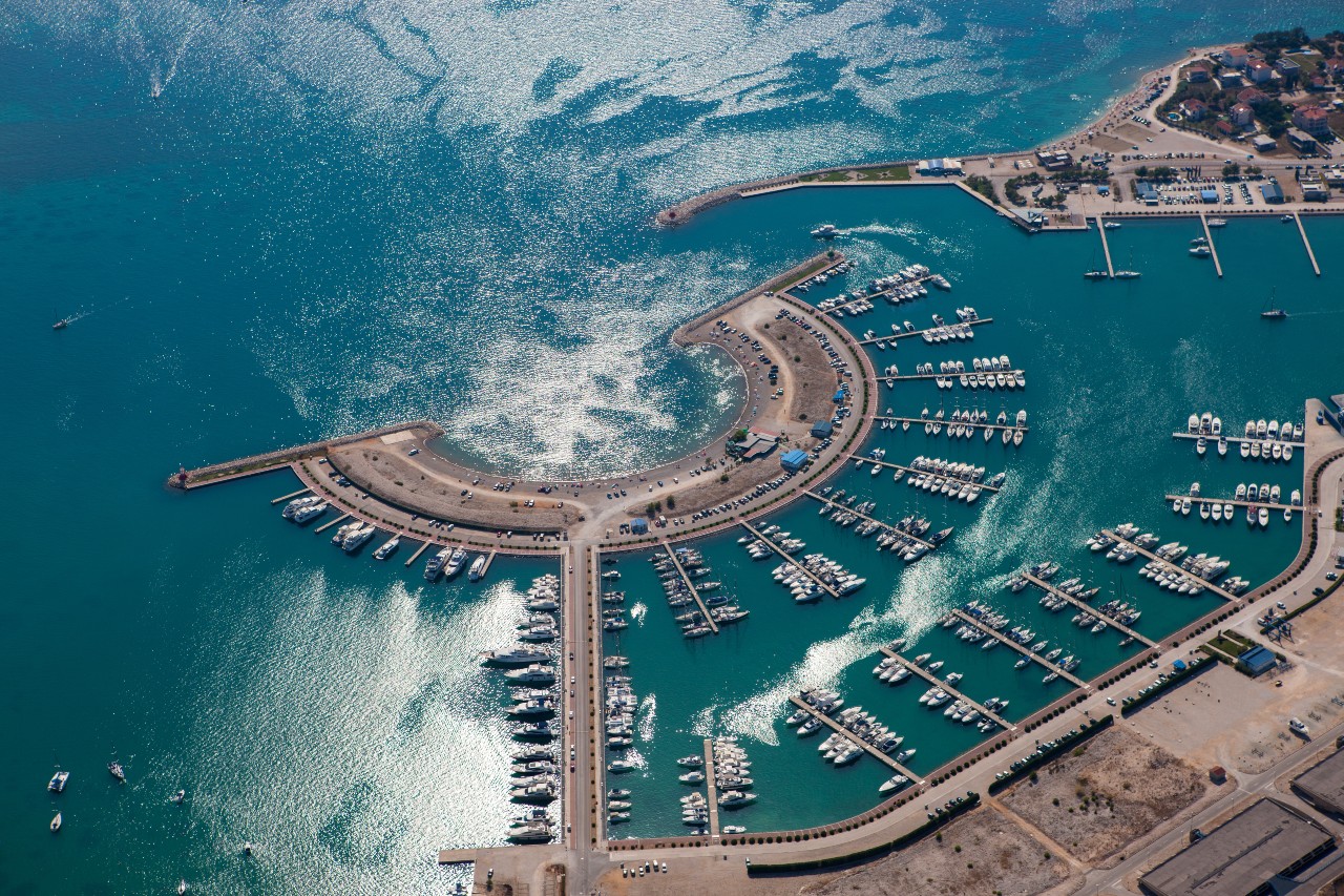

Day 1: Sukošan, Marina D-Marin Dalmacija – Lanđin Bay, Pašman Island (17.00 NM)
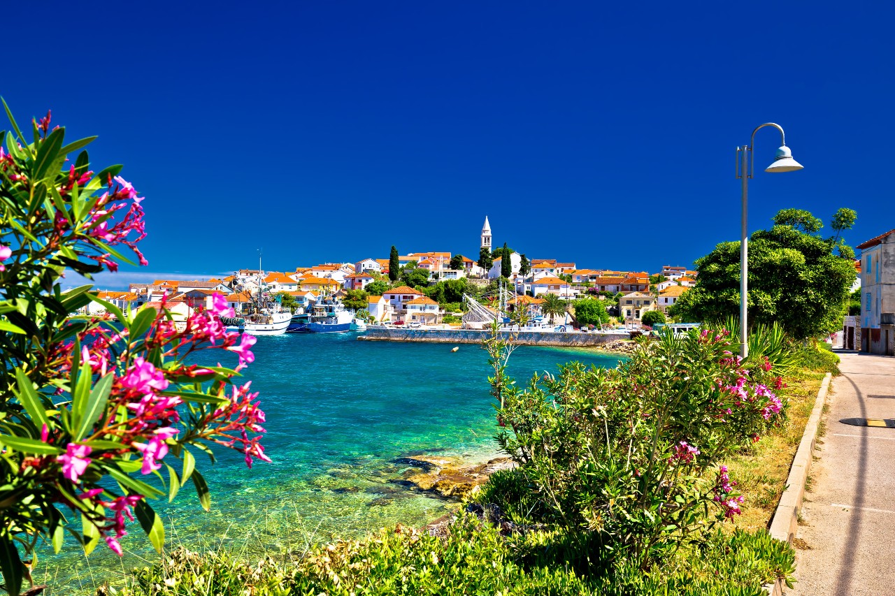
Sail downwind through the channel between the mainland and the island of Pašman. Stay the night in Lanđin Bay on the SW side of Pašman Island. This bay is usually calm, and the anchor is holding well. One can also rely on a few buoys owned by local taverns where local food is served at a fair price.
Day 2: Lanđin Bay, Pašman Island – Kornati National Park (20.00 NM)
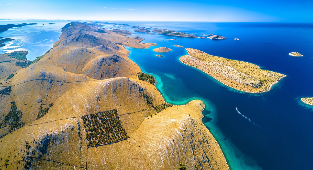
The suggested route to get to Kornati National Park leads south, to the southernmost part of Kornat Island, the largest one in the archipelago. A good spot to enter the Park is through the strait between the island of Kornat and Smokvica Vela Islet. The archipelago then spreads to the NW. Once in the park, it is important to respect the regulations regarding nature protection and navigate carefully due to the numerous shallows and underwater rocks.
Those who prefer marina accommodation can stay in ACI Marina Piškera on the W border of the park. Visitors of the ACI marina Piškera are granted a free 24-hour ticket to Kornati National Park.
Day 3: Kornati National Park – Nature Park Telašćica – Sali, Dugi Otok Island (18.00 NM)
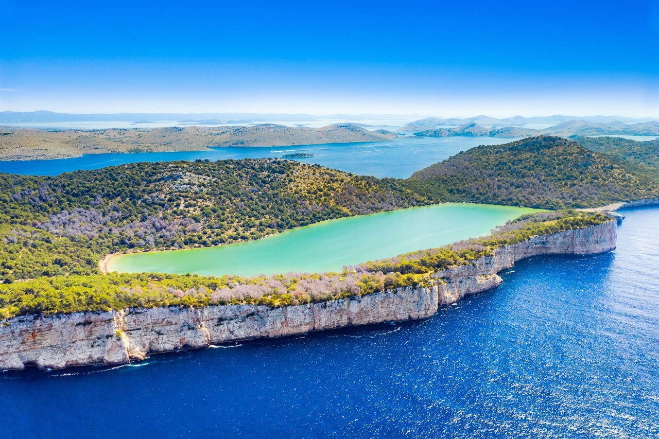
Take the route west from the border of Kornati and continue to the shores of Dugi Otok island. This path offers stunning views of the famous cliffs of Kornati islands and Dugi Otok. The south part of Dugi Otok island belongs to Nature Park Telašćica, a good spot for a swim break or even a short hiking tour to the viewpoints over the cliffs and to a salt lake called Mir (Peace).
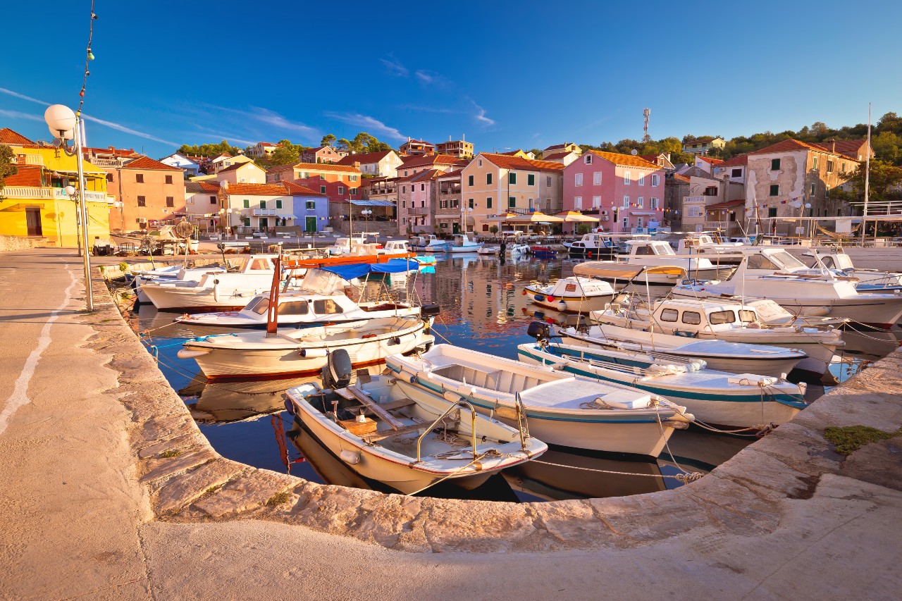
Visiting, and especially the overnight stay in Nature Park Telašćica requires a ticket. One may spend the night within the park, but the route suggests an overnight stay in Sali. To get there one must sail through the Proversa Mala strait and head NW following the shores of Dugi Otok Island.
Day 4: Sali, Dugi Otok Island – Veli Rat, Dugi Otok Island (25.00 NM)
Head northwest following the shores of Dugi Otok Island. There are many opportunities to drop anchor at one of the numerous bays on the way such as Brbinj on Dugi Otok Island or somewhere on the islets of Rava and Zverinac. An overnight stay is planned on the NW end of Dugi Otok Island. Solišćica Bay and Pantera Bay are safe for anchoring while safe berth can be found on the pontoons of Veli Rat Marina.
Day 5: Veli Rat, Dugi otok – Muline Bay, Ugljan Island (15.00 NM)
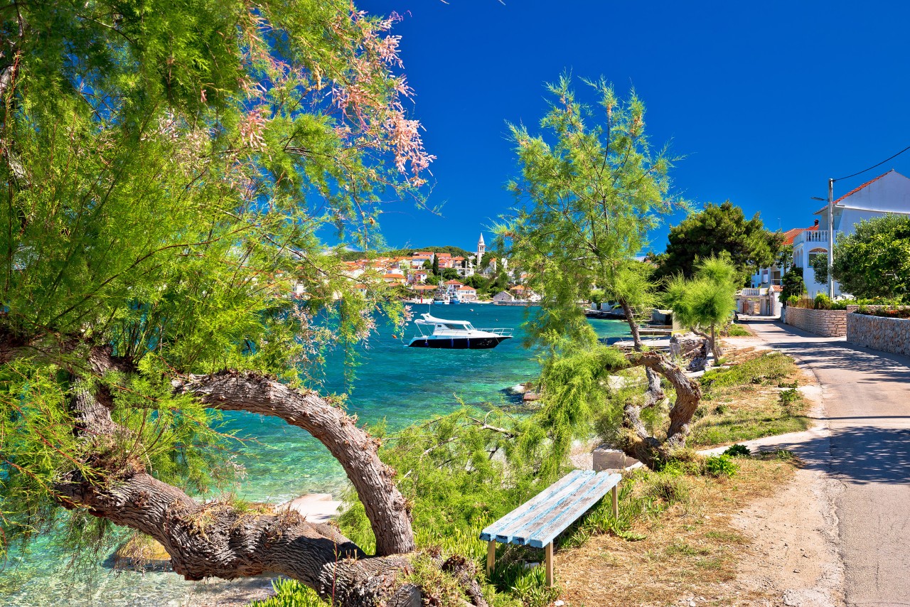
Head north-northeast, pass the islets of Golac and Bršćak, turn east and pass the strait between the islands of Tun and Molat and the northwest cape of Sestrunj Island. The other way to reach Muline Bay on the NW cape of Ugljan Island leads south from the islands of Tun, Molat and Sestrunj, after leaving Dugi Otok's NW cape. Muline Bay is a safe and calm anchorage while a cluster of buoys is offered at a fair price. Besides a calm overnight stay, you can have a simple meal in a tavern ashore.
Day 6: Muline Bay, Ugljan Island – Vrgada - Sukošan, Marina D-Marin Dalmacija (14.00 NM)
The final day of the trip is meant to be a relaxed downwind sail through the channel between the mainland and Ugljan Island. A swim break is scheduled for the sandy beaches of Vrgada Island or the area below the Ždrelac Bridge, in the strait between the islands of Ugljan and Pašman. In case the charter agency allows the return on Saturday morning, we advise you to spend the night in Kali on Ugljan Island, which is not more than 2.6 NM away from Marina D-Marin Dalmacija in Sukošan.