
How Maritime Navigation is Changing: From Compass to Digital Charts

How Maritime Navigation is Changing: From Compass to Digital Charts
Navigating at sea used to be like magic - all you needed was a compass and a sextant and you felt like a modern-day Wizard of Oz. But what if I told you that today you don't even need those tools to find your way across the vast oceans? Thanks to digital charts, navigation has become so easy that even a grandmother with zero-degrees north nautical experience could do it. So how did we get from these good old-fashioned aids to the technology that laughs in our faces from our screens today? Get ready to sail through time!
History and development of navigation methods at sea
When we delve into the history of maritime navigation, it's like opening an old pirate diary full of secrets and daring adventures. The daredevils who left safe harbours knew that their success depended on their ability to find their way across the endless sea. Do you still remember the Phoenicians, the Greeks or the Vikings? These fighters were pioneers in the world of maritime navigation. And how do you think they'd feel about the GPS in their pockets today?
In ancient times, mariners relied heavily on celestial bodies - the sun, moon and stars were their companions. Astronavigation was their magic key to navigating the oceans. And when you have an astrolabe handy, you're basically the Captain Jack Sparrow of your time.
How the compass worked and its importance to seafarers
Now imagine the moment someone came up with the idea of a compass. For the sailors of the time, it was like winning the lottery jackpot! A little piece of technology from 4th century China made an impression on Mediterranean sailors a few hundred years later. The compass was a revolution - it showed the cardinal points without the need to look at the sky.
Aboard ship, the compass meant certainty in the face of uncertainty. Following a course became much easier thanks to the earth's magnetic field lines. It's kind of funny that we consider it "retro" technology today, but it was once the cutting edge of technology.
What did the sextant bring to maritime navigation?
And then there was the sextant - another treasure for sailors in their collection of navigation toys. This wonderful instrument made it possible to measure the angles between celestial bodies and the horizon with a precision that ancient mariners would have considered magic.
The Sextant completely changed the game: it made it possible to determine a ship's position with an accuracy of several kilometres. Using a sextant? It's like cooking with your grandmother's recipe - it takes a little practice and a lot of patience, but the results are worth it.
Transition from traditional methods to digital technologies
As time passed and technology began to outdo itself (or rather, sail at the speed of modern yachts), these old methods began to seem a bit outdated. Imagine the shock in the eyes of sailors when radio and radar came into play! Suddenly it was possible to see over the horizon - literally!
But who would have guessed the draught of the future in the form of satellite systems? When GPS arrived in the civilian sector in the early 21st century, it opened up a new world of possibilities for boaters of all skill levels.
What options do today's digital charts offer sailor
Today's digital maps are like a navigation wizard on your phone or tablet. No more old parchments! These apps offer up-to-the-minute weather, tide information or warnings of dangerous areas.
With modern technology, every sailor can be the captain of their own expedition - you don't even need to have a whole crew of astronomers on board. Thanks to satellite imagery, the whole world is literally at your fingertips, ready to be explored.
So what do you think? Have I answered at least part of the "where is home" question? Hopefully this quick look into the history of nautical navigation will inspire you to further adventures at sea!
So, sailors, next time you hit the waves, remember the days of compasses and sextants. And don't forget that with digital charts, navigation is a breeze these days - almost like taking a selfie on Instagram!
Latest from Blog

Peace, quiet, and the endless sea: The magic of a boat vacation
Do you remember that vacation you came back from more exhausted than when you left? The line for breakfast, the loud entertainers by the pool, and the never-ending battle for a lounge chair—which felt more like a morning supermarket clearance sale than a well-deserved break? I certainly do. And I’m far from the only one who said to myself, “Never again.”
Trends are changing. And they’re changing dramatically. Welcome to an era where simple silence is becoming the greatest luxury.
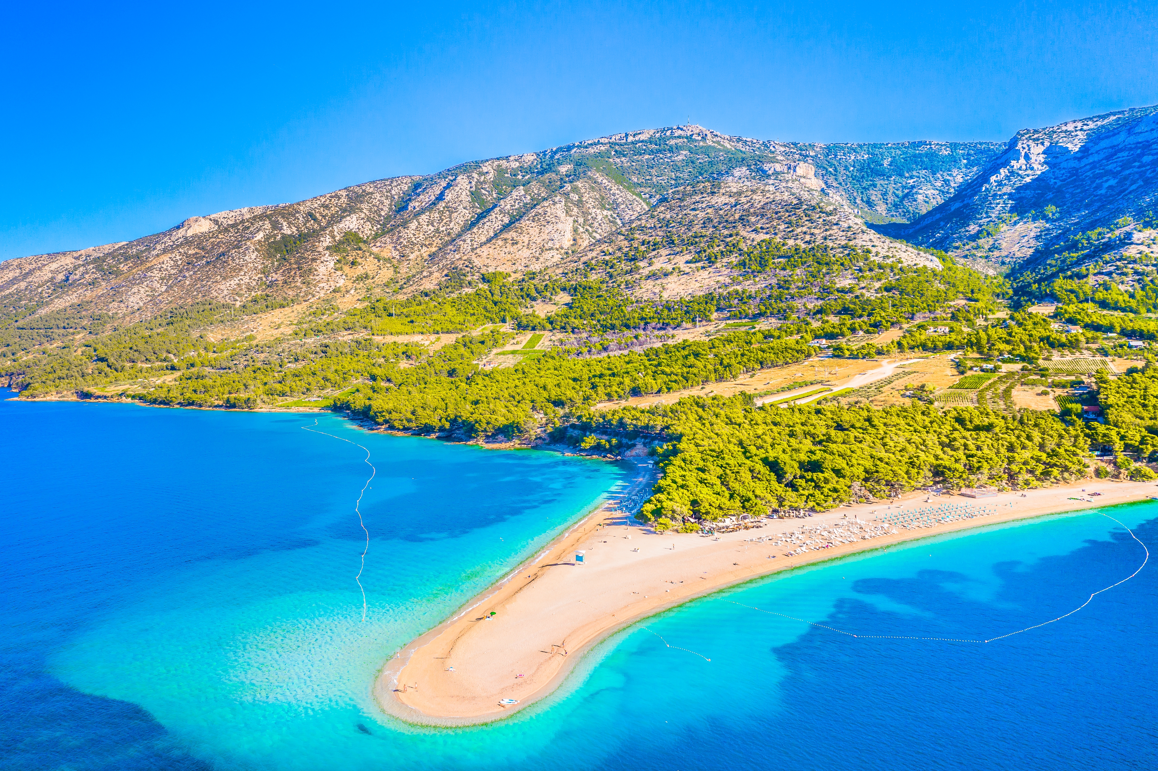
Where are the best places to swim on the Adriatic? A Guide for Sailors
Croatia is close by, with crystal-clear waters, a rugged coastline, and thousands of islands glistening on the horizon. And when you add to that the privacy of your own sailboat, which will take you exactly where you point on the map… well, tell me, can you resist? Let’s take a look together at the best places to swim in the Adriatic—and, most importantly, why yachting in Croatia is the smartest way to discover this country.
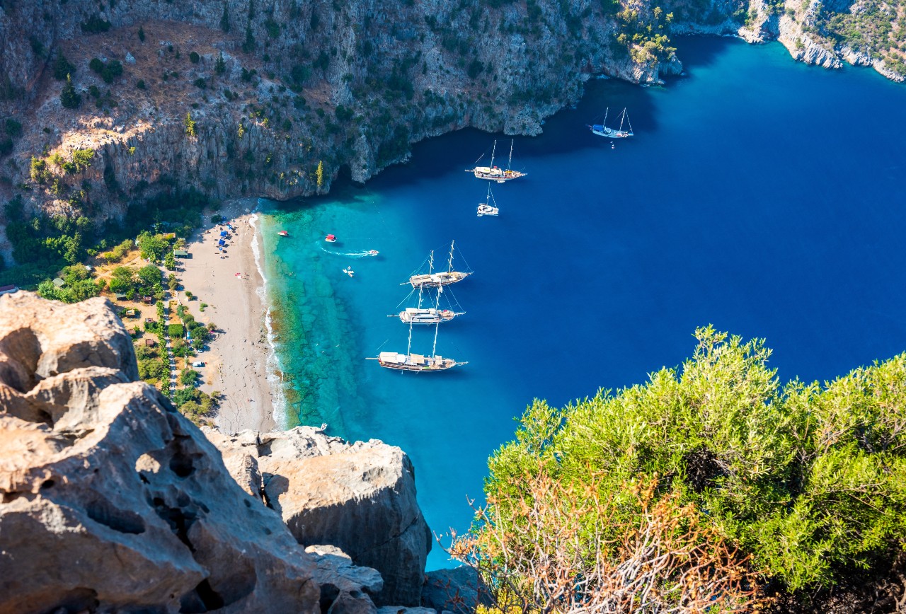
Yachting in Turkey: Discover the most beautiful spots along the Turquoise Coast
Are you tired of perpetually crowded Croatian marinas and overpriced Italian ports? I certainly am. So I started looking further east—and discovered a destination that took my breath away. Yachting in Turkey is no compromise, but a full-fledged experience that in many ways puts the classic Mediterranean to shame. A turquoise coastline, ancient ruins peeking out from the cliffs, bays straight out of a paradise vacation ad, and prices that won’t break the bank. Let’s see why you should pack your swimsuit and head right here.